Three Analemmas
Description
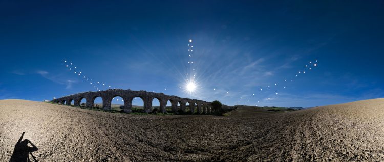
The Analemma is the orthographic projection of the apparent motion of the Sun on the plane of the local meridian; it is used to determine the height of the stars, in particular, that of the Sun because it is useful for building sundials (also called quadrants or analemmatic clocks).
Often, looking at the sundials, a curve in the shape of an “8” can be observed which intersects the hour lines. This curve is called the analemma or lemniscate.
However, with a photographic trick, the analemma can also be seen projected in the sky: in the history of astronomical photography, Dennis Di Cicco was one of the first in the 1990s to come up with the idea of photographing the Sun for a year (when passes to the Meridian) always at the same time and at constant daily intervals. The result consists in seeing the “8” curve projected into the sky in a southerly direction. This intuition subsequently spread to such an extent that the analemma photos are still widespread today.
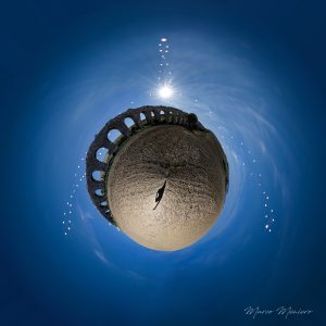
Following this idea, I created a photographic composition by joining the analemma curve with two other curves created with the same technique but at different times: the one on the left at 07:20 UTC and the one on the right at 15:00 UTC. Furthermore, on the day of the winter solstice I resumed the path of the Sun throughout the day. You can see the curves close to twilight strongly inclined unlike the one at the Meridian which is vertical.
I took the three curves from the Viterbo Airport, but from my position I was unable to resume the panorama because I could see military installations and therefore I decided to move 30km considering that this difference does not visibly change the analemma.
Technical details – analemma curve:
Filming start March 2022, filming end March 2023, filming frequency: on average one shot every 15 days, with minimum intervals of 7 days and maximum of 20 days. Based on cloud conditions.
Shooting times: 07:20 -11:10-15:00 UTC
Shooting camera: Nikon Z9 set to ISO 32
Nikon S14-24/2.8 lens closed to f/22
Shutter Speed: 1/32,000th to 1/8000th depending on sky conditions. 80 photos of the solar disks were taken, but only 68 were used.
Shooting site Viterbo Airport (42.22.228N-12.05878E), Italy.
Technical details – panorama:
Taken on 1 November 2022, 11:10 UTC
Nikon Z9 camera set to ISO 32
Nikon S14-24/2.8 lens closed to f/6.2 with 1/160 times.
Sum of two 360-degree panoramas of 12 shots each: one on the ground and one on the sky.
The pan has a range of 360 degrees in azimuth and 130 degrees in elevation. Location: Arcatelle Aqueduct (Tarquinia, Viterbo, Italy – 42.258649N-11.815915).
Photo processing with Photoshop and study of the analemma with Starry Night 8. Having taken both the panorama and the curves with the same focal length (14mm) made it easier to maintain the heights and azimuth angles of the curves.


comments (0)