Light Trails
Description
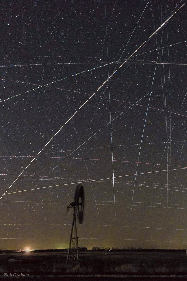
A Notable Photo of the 2014 International Earth & Sky Photo Contest
From the photographer: “Kansas is in the heart of the Central Flyway for bird migration, but is also known as flyover country. This photo shows how much air/space traffic there was in 33 minutes over the northern edge of Cheyenne Bottoms WA, a Wetlands of International Importance. The horizontal and diagonal lines are planes. I think many of the vertical streaks are satellites. The central vertical streak exhibits an iridium flare created by a passing satellite. Polaris sits 2/3 of the way up from the bottom. A passing car provided the light for the windmill and foreground. Only a few photos from the sequence possessed no light trails, demonstrating how hard it can be to capture the beauty of the night sky without interference from man made objects.”
comments (0)